 Imagen diaria
Nubosidad sobre México:2%
Datos nulos en la escena:42%
Datos nulos sobre México:26%
| Área |
Imagen diaria |
Nubosidad en el terreno:2% Nubosidad sobre México:2% Datos nulos en la escena:42% Datos nulos sobre México:26% |
|
Punto de calor
Se considera como punto de calor al elemento espacial mínimo de la imagen (pixel) que reporta una temperatura elevada. Para las imágenes diurnas la temperatura mínima considera es de 42 C y para las imágenes nocturnas es de 25 C. |
Índice de propagación de incendios
Indica el riesgo de propagación de incendios forestales. Se basa exclusivamente en el vigor de la vegetación, cuanto más seca está la vegetación, más rápido se podrá extender el posible fuego (incendio). Los valores para el índice son: Bajo -> Normal -> Alto -> Muy alto NA (No aplica) se refiere al agua, vegetación no arbolada y los usos de suelo mostrados en gris. ND (No disponible) indica que no hubo información para generar el índice. 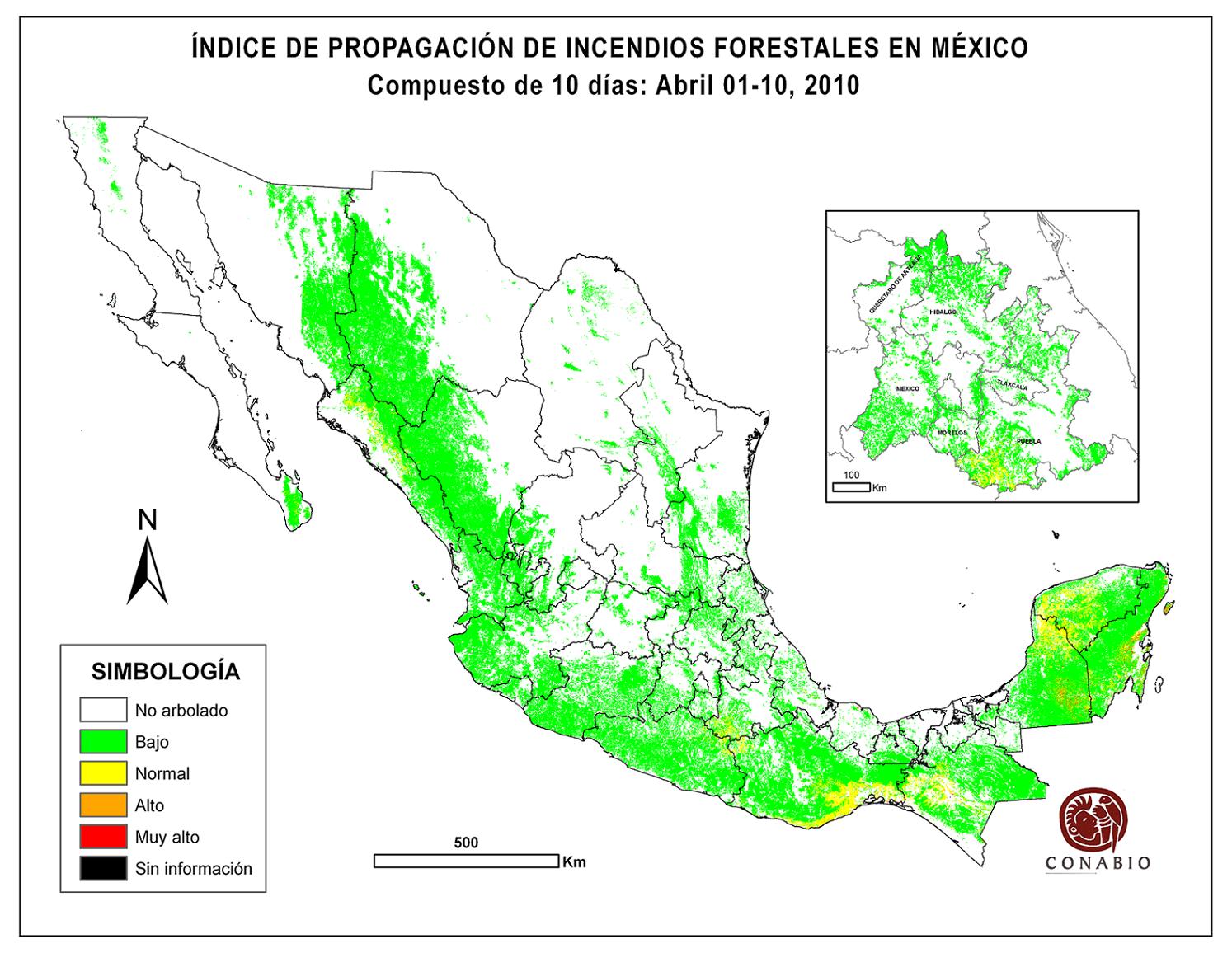 Imagen del índice de propagación de incendios Imagen del índice de propagación de incendios
|
|
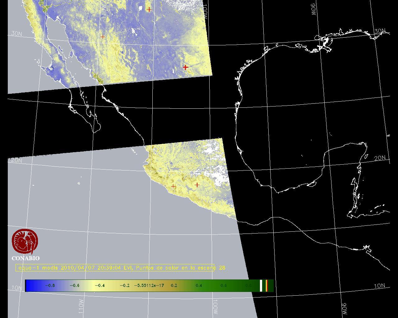
Índice de vegetación
Los valores del índice van de -1 a 1, entre más cercano al valor 1 la vegetación presenta mayor vigor. Los índices de vegetación son utilizados para conocer el comportamiento de la vegetación tanto espacial como temporal. |
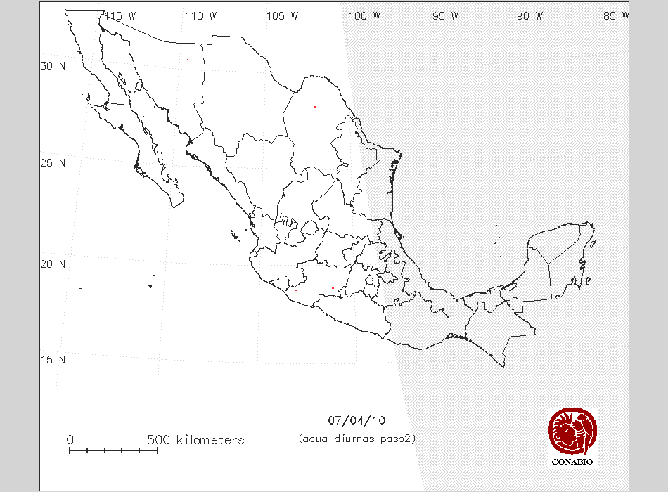 Imagen de puntos de calor Imagen de puntos de calor |
 Índice de vegetación Índice de vegetación |
| X= Vegetación con alta susceptibilidad de incendios | Nota: Para obtener puntos de calor sobre un Modelo Digital del Terreno y Vegetación, seleccionar el número en la columna "Indice". Los siguientes usos de suelo se muestran en gris: agricultura, área sin vegetación, cuerpos de agua, pastizal cultivado e inducido. |
| Indice | Total de pixeles | Longitud | Latitud | Tipo de Vegetación | Municipio/Estado | Areas naturales protegidas | Pendiente | Indice de propagación | |
| X | 1 | -102 7 59 | 28 17 7 | Pastizal natural | San Buenaventura,Coahuila | CUENCA ALIMENTADORA DEL DISTRITO NACIONAL DE RIEGO 004 DON MARTIN | 0 ° | NA | |
| X | 1 | -102 7 22 | 28 16 34 | Pastizal natural | San Buenaventura,Coahuila | CUENCA ALIMENTADORA DEL DISTRITO NACIONAL DE RIEGO 004 DON MARTIN | 5 ° | NA | |
| X | 1 | -102 7 59 | 28 16 2 | Pastizal natural | San Buenaventura,Coahuila | CUENCA ALIMENTADORA DEL DISTRITO NACIONAL DE RIEGO 004 DON MARTIN | 6 ° | NA | |
| 1 | -102 7 59 | 28 15 29 | Matorral desértico rosetófilo | San Buenaventura,Coahuila | CUENCA ALIMENTADORA DEL DISTRITO NACIONAL DE RIEGO 004 DON MARTIN | 9 ° | NA | ||
| X | 1 | -102 7 22 | 28 15 29 | Pastizal natural | San Buenaventura,Coahuila | CUENCA ALIMENTADORA DEL DISTRITO NACIONAL DE RIEGO 004 DON MARTIN | 7 ° | NA | |
| X | 1 | -102 7 22 | 28 14 56 | Pastizal natural | San Buenaventura,Coahuila | CUENCA ALIMENTADORA DEL DISTRITO NACIONAL DE RIEGO 004 DON MARTIN | 3 ° | NA | |
| 1 | 7 | -102 7 59 | 28 14 24 | Matorral desértico rosetófilo | San Buenaventura,Coahuila | CUENCA ALIMENTADORA DEL DISTRITO NACIONAL DE RIEGO 004 DON MARTIN | 8 ° | NA | |
| 2 | -102 6 9 | 28 17 7 | Matorral desértico rosetófilo | San Buenaventura,Coahuila | CUENCA ALIMENTADORA DEL DISTRITO NACIONAL DE RIEGO 004 DON MARTIN | 1 ° | NA | ||
| 2 | -102 6 9 | 28 16 34 | Matorral desértico rosetófilo | San Buenaventura,Coahuila | CUENCA ALIMENTADORA DEL DISTRITO NACIONAL DE RIEGO 004 DON MARTIN | 0 ° | NA | ||
| 2 | -102 5 32 | 28 16 34 | Matorral desértico rosetófilo | San Buenaventura,Coahuila | CUENCA ALIMENTADORA DEL DISTRITO NACIONAL DE RIEGO 004 DON MARTIN | 19 ° | NA | ||
| X | 2 | -102 5 32 | 28 16 2 | Chaparral | San Buenaventura,Coahuila | CUENCA ALIMENTADORA DEL DISTRITO NACIONAL DE RIEGO 004 DON MARTIN | 4 ° | NA | |
| 2 | -102 6 9 | 28 15 29 | Bosque de encino - vegetación secundaria arbustiva | San Buenaventura,Coahuila | CUENCA ALIMENTADORA DEL DISTRITO NACIONAL DE RIEGO 004 DON MARTIN | 16 ° | NA | ||
| 2 | -102 5 32 | 28 14 57 | Bosque de encino - vegetación secundaria arbustiva | San Buenaventura,Coahuila | CUENCA ALIMENTADORA DEL DISTRITO NACIONAL DE RIEGO 004 DON MARTIN | 21 ° | NA | ||
| 2 | 7 | -102 5 32 | 28 14 24 | Matorral desértico rosetófilo | San Buenaventura,Coahuila | CUENCA ALIMENTADORA DEL DISTRITO NACIONAL DE RIEGO 004 DON MARTIN | 22 ° | NA | |
| 3 | -102 9 13 | 28 15 29 | Matorral desértico rosetófilo | San Buenaventura,Coahuila | CUENCA ALIMENTADORA DEL DISTRITO NACIONAL DE RIEGO 004 DON MARTIN | 4 ° | NA | ||
| 3 | -102 9 49 | 28 14 56 | Matorral desértico rosetófilo | San Buenaventura,Coahuila | CUENCA ALIMENTADORA DEL DISTRITO NACIONAL DE RIEGO 004 DON MARTIN | 9 ° | NA | ||
| 3 | 3 | -102 9 13 | 28 14 24 | Matorral desértico rosetófilo | San Buenaventura,Coahuila | CUENCA ALIMENTADORA DEL DISTRITO NACIONAL DE RIEGO 004 DON MARTIN | 5 ° | NA | |
| 4 | -101 7 30 | 18 56 27 | Selva baja caducifolia - vegetación secundaria arbórea | Carácuaro,Michoacán | NO AFECTA | 2 ° | NA | ||
| 4 | 2 | -101 8 4 | 18 55 55 | Agricultura de temporal | Carácuaro,Michoacán | NO AFECTA | 12 ° | NA | |
| 5 | 1 | -101 9 13 | 18 55 55 | Selva baja caducifolia - vegetación secundaria arbórea | Carácuaro,Michoacán | NO AFECTA | 10 ° | NA | |
| 6 | -103 7 19 | 18 48 45 | Selva baja caducifolia - vegetación secundaria arbustiva | Coalcomán de Vázquez Pallares,Michoacán | NO AFECTA | 15 ° | NA | ||
| 6 | 2 | -103 7 19 | 18 48 12 | Selva baja caducifolia - vegetación secundaria arbustiva | Coalcomán de Vázquez Pallares,Michoacán | NO AFECTA | 7 ° | Bajo | |
| 7 | 1 | -109 38 3 | 30 30 1 | Mina | Nacozari de García,Sonora | NO AFECTA | 0 ° | Bajo |
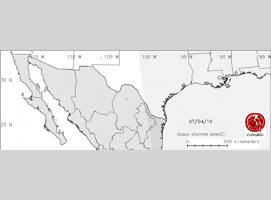 Imagen de puntos de calor Imagen de puntos de calor |
| Indice | Total de pixeles | Longitud | Latitud | Estado |
| 1 | 1 | -105 29 7 | 32 47 39 | New Mexico |
| 2 | -105 30 21 | 32 46 33 | New Mexico | |
| 2 | -105 29 43 | 32 46 34 | New Mexico | |
| 2 | -105 29 5 | 32 46 35 | New Mexico | |
| 2 | 4 | -105 28 27 | 32 46 36 | New Mexico |